Archaeologists map entire Roman town without digging
Experts say ‘awe-inspiring’ new images show ground-penetrating radar’s potential for use in major sites elsewhere in Mediterranean. Jon Sharman reports
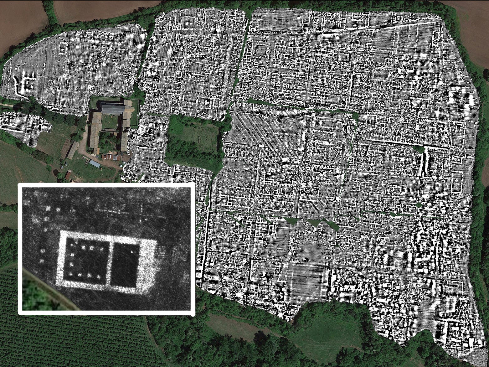
Archaeologists have revealed the layout of an ancient Roman town in unprecedented detail – without any digging.
A team from the University of Cambridge and Belgium’s Ghent University used ground-penetrating radar (GPR) to map Falerii Novi and discovered, among other things, a sprawling network of water pipes dating back to the third century.
GPR uses radio waves and their echoes to build a high-resolution picture of what lies beneath a patch of ground. It has been used to peer even further back in time than the Roman era, with Cornell University researchers recently discovering human footprints dating to the last ice age in New Mexico.
Subscribe to Independent Premium to bookmark this article
Want to bookmark your favourite articles and stories to read or reference later? Start your Independent Premium subscription today.
Join our commenting forum
Join thought-provoking conversations, follow other Independent readers and see their replies